Geolocate

Venlo topographic map

Interactive map

Click on the map to display elevation.

About this map

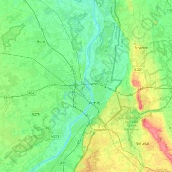
Name: Venlo topographic map, elevation, terrain.

Location: Venlo, Limburg, Netherlands (51.27706 6.07178 51.50782 6.22677)

Average elevation: 32 m

Minimum elevation: 10 m

Maximum elevation: 92 m

Other topographic maps

Click on a map to view its topography, its elevation and its terrain.

Maastricht

Netherlands > Limburg

Maastricht, Limburg, Netherlands

Average elevation: 73 m

Heerlen

Netherlands > Limburg > Heerlen

Heerlen, Limburg, Netherlands

Average elevation: 133 m

Weert

Netherlands > Limburg

Weert, Limburg, Netherlands

Average elevation: 33 m

Maastricht

Netherlands > Limburg > Maastricht

Maastricht, Eijsden-Margraten, Limburg, Netherlands

Average elevation: 73 m

Vaals

Netherlands > Limburg

Vaals, Limburg, Netherlands

Average elevation: 198 m