
Wechelderzande topographic map
Interactive map
Click on the map to display elevation.
About this map
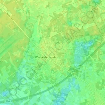
Name: Wechelderzande topographic map, elevation, terrain.
Location: Wechelderzande, Lille, Turnhout, Antwerpen, België (51.24253 4.76131 51.28824 4.82042)
Average elevation: 17 m
Minimum elevation: 8 m
Maximum elevation: 23 m
Other topographic maps
Click on a map to view its topography, its elevation and its terrain.