
Ashe County topographic map
Interactive map
Click on the map to display elevation.
About this map
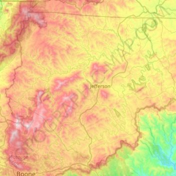
Name: Ashe County topographic map, elevation, terrain.
Location: Ashe County, North Carolina, United States (36.24004 -81.74188 36.58816 -81.23921)
Average elevation: 950 m
Minimum elevation: 350 m
Maximum elevation: 1,680 m