
Namur topographic map
Interactive map
Click on the map to display elevation.
About this map
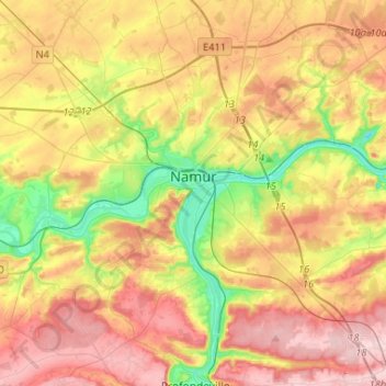
Name: Namur topographic map, elevation, terrain.
Location: Namur, Wallonia, Belgium (50.38728 4.72305 50.53110 4.98418)
Average elevation: 177 m
Minimum elevation: 59 m
Maximum elevation: 286 m