
Hadjout topographic map
Interactive map
Click on the map to display elevation.
About this map
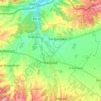
Name: Hadjout topographic map, elevation, terrain.
Location: Hadjout, Daïra Hadjout, Tipaza, Algérie (36.48732 2.34926 36.55976 2.47265)
Average elevation: 110 m
Minimum elevation: 16 m
Maximum elevation: 277 m
Other topographic maps
Click on a map to view its topography, its elevation and its terrain.