
Sylt topographic map
Interactive map
Click on the map to display elevation.
About this map
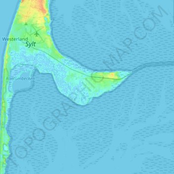
Name: Sylt topographic map, elevation, terrain.
Location: Sylt, Nordfriesland, Schleswig-Holstein, 25980, Deutschland (54.79571 8.28045 54.93115 8.55104)
Average elevation: 1 m
Minimum elevation: -4 m
Maximum elevation: 27 m
Other topographic maps
Click on a map to view its topography, its elevation and its terrain.
Hindenburgdamm
Deutschland > Schleswig-Holstein > Sylt
Hindenburgdamm, Morsum Kliff - NSG, Morsum, Sylt, Nordfriesland, Schleswig-Holstein, 25980, Deutschland
Average elevation: 0 m