
Berga topographic map
Interactive map
Click on the map to display elevation.
About this map
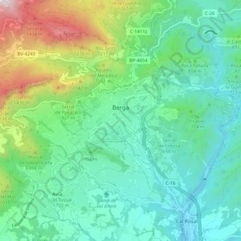
Name: Berga topographic map, elevation, terrain.
Location: Berga, Berguedà, Barcelona, 08600, España (42.07109 1.79901 42.12394 1.88774)
Average elevation: 783 m
Minimum elevation: 476 m
Maximum elevation: 1,706 m
Other topographic maps
Click on a map to view its topography, its elevation and its terrain.