
Villa Imperial de Potosí topographic map
Interactive map
Click on the map to display elevation.
About this map
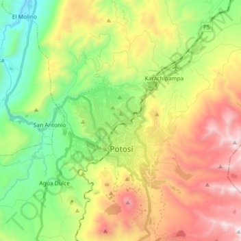
Name: Villa Imperial de Potosí topographic map, elevation, terrain.
Average elevation: 4,048 m
Minimum elevation: 3,367 m
Maximum elevation: 5,017 m
Other topographic maps
Click on a map to view its topography, its elevation and its terrain.
Cantumarca
Bolivia > Potosí > Villa Imperial de Potosí > Cantumarca
Cantumarca, Villa Imperial de Potosí, Provincia Tomás Frías, Potosí, 36, Bolivia
Average elevation: 3,797 m