
Gouraya topographic map
Interactive map
Click on the map to display elevation.
About this map
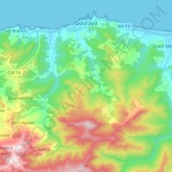
Name: Gouraya topographic map, elevation, terrain.
Location: Gouraya, Daïra Gouraya, Tipaza, 42007, Algérie (36.48510 1.84613 36.57942 1.98040)
Average elevation: 309 m
Minimum elevation: -2 m
Maximum elevation: 999 m