
Santiago topographic map
Interactive map
Click on the map to display elevation.
About this map
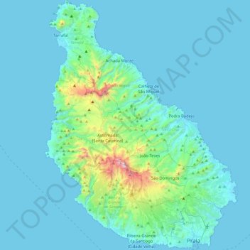
Name: Santiago topographic map, elevation, terrain.
Location: Santiago, Santa Catarina, Cape Verde (14.89994 -23.78162 15.34018 -23.42835)
Average elevation: 115 m
Minimum elevation: 0 m
Maximum elevation: 1,297 m
Other topographic maps
Click on a map to view its topography, its elevation and its terrain.