
Serafimovichsky District topographic map
Interactive map
Click on the map to display elevation.
About this map
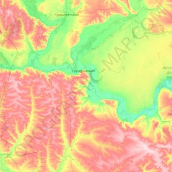
Name: Serafimovichsky District topographic map, elevation, terrain.
Average elevation: 124 m
Minimum elevation: 39 m
Maximum elevation: 247 m
Other topographic maps
Click on a map to view its topography, its elevation and its terrain.
Tsimlyansk Reservoir
Russia > Volgograd Oblast > Тормосиновское сельское поселение
Tsimlyansk Reservoir, Тормосиновское сельское поселение, Чернышковский район, Volgograd Oblast, South federal district, 347360, Russia
Average elevation: 77 m