
Tacamoros topographic map
Interactive map
Click on the map to display elevation.
About this map
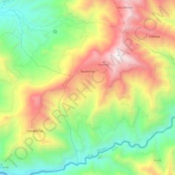
Name: Tacamoros topographic map, elevation, terrain.
Location: Tacamoros, Cantón Sozoranga, 110704, Ecuador (-4.48396 -79.79268 -4.38279 -79.67843)
Average elevation: 1,424 m
Minimum elevation: 570 m
Maximum elevation: 2,571 m