
Central Bosnia Canton topographic map
Interactive map
Click on the map to display elevation.
About this map
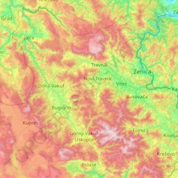
Name: Central Bosnia Canton topographic map, elevation, terrain.
Average elevation: 940 m
Minimum elevation: 206 m
Maximum elevation: 2,089 m
Other topographic maps
Click on a map to view its topography, its elevation and its terrain.
Tuzla
B&H > Federation of Bosnia and Herzegovina > Tuzla
Tuzla, City of Tuzla, Tuzla Canton, Federation of Bosnia and Herzegovina, 75000, B&H
Average elevation: 349 m
Canton 10
B&H > Federation of Bosnia and Herzegovina
Canton 10, Federation of Bosnia and Herzegovina, B&H
Average elevation: 931 m
Herzegovina-Neretva Canton
B&H > Federation of Bosnia and Herzegovina
Herzegovina-Neretva Canton, Federation of Bosnia and Herzegovina, B&H
Average elevation: 672 m