
East Khasi Hills topographic map
Interactive map
Click on the map to display elevation.
About this map
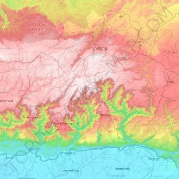
Name: East Khasi Hills topographic map, elevation, terrain.
Location: East Khasi Hills, Meghalaya, India (25.12667 91.35476 25.72171 92.15713)
Average elevation: 956 m
Minimum elevation: 4 m
Maximum elevation: 1,957 m