
Bourkika topographic map
Interactive map
Click on the map to display elevation.
About this map
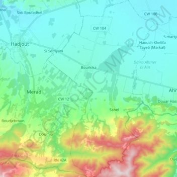
Name: Bourkika topographic map, elevation, terrain.
Location: Bourkika, Daïra Ahmer El Aïn, Tipaza, Algérie (36.41340 2.43924 36.54401 2.53777)
Average elevation: 204 m
Minimum elevation: 38 m
Maximum elevation: 751 m
Other topographic maps
Click on a map to view its topography, its elevation and its terrain.
Ahmer El Aïn
Algérie > Tipaza > Daïra Ahmer El Aïn
Ahmer El Aïn, Daïra Ahmer El Aïn, Tipaza, 42005, Algérie
Average elevation: 91 m
Sidi Rached
Algérie > Tipaza > Daïra Ahmer El Aïn
Sidi Rached, Daïra Ahmer El Aïn, Tipaza, 42250, Algérie
Average elevation: 78 m