
Thank you for supporting this site ❤️
Make a donation
Make a donation
Benguet topographic map
Click on the map to display elevation.
Thank you for supporting this site ❤️
Make a donation
Make a donation
About this map
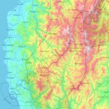
Name: Benguet topographic map, elevation, terrain.
Location: Benguet, Cordillera Administrative Region, Philippines (16.18100 120.46191 16.92044 120.89880)
Average elevation: 883 m
Minimum elevation: -1 m
Maximum elevation: 2,841 m
Thank you for supporting this site ❤️
Make a donation
Make a donation
Other topographic maps
Click on a map to view its topography, its elevation and its terrain.