
Colleyville topographic map
Interactive map
Click on the map to display elevation.
About this map
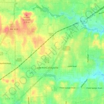
Name: Colleyville topographic map, elevation, terrain.
Location: Colleyville, Tarrant County, Texas, 76034, United States (32.86012 -97.18679 32.92374 -97.09982)
Average elevation: 191 m
Minimum elevation: 166 m
Maximum elevation: 221 m
Other topographic maps
Click on a map to view its topography, its elevation and its terrain.