
Saratoga County topographic map
Interactive map
Click on the map to display elevation.
About this map
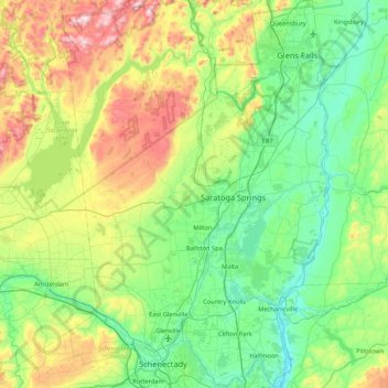
Name: Saratoga County topographic map, elevation, terrain.
Location: Saratoga County, New York, USA (42.77546 -74.16010 43.39797 -73.57327)
Average elevation: 218 m
Minimum elevation: 3 m
Maximum elevation: 833 m
Other topographic maps
Click on a map to view its topography, its elevation and its terrain.