
Pak Sha O topographic map
Interactive map
Click on the map to display elevation.
About this map
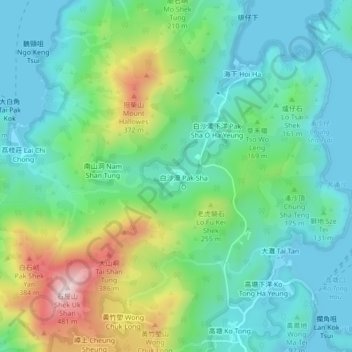
Name: Pak Sha O topographic map, elevation, terrain.
Location: Pak Sha O, Tai Po District, Hong Kong, PRC (22.42875 114.29981 22.46875 114.33981)
Average elevation: 128 m
Minimum elevation: -2 m
Maximum elevation: 466 m