Geolocate

Regional District of East Kootenay topographic map

Interactive map

Click on the map to display elevation.

About this map

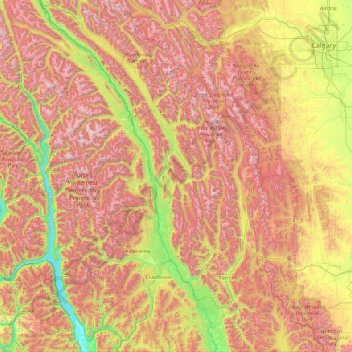
Name: Regional District of East Kootenay topographic map, elevation, terrain.

Location: Regional District of East Kootenay, British Columbia, Canada (48.99887 -116.79790 51.33416 -114.05414)

Average elevation: 1,628 m

Minimum elevation: 526 m

Maximum elevation: 3,357 m

Other topographic maps

Click on a map to view its topography, its elevation and its terrain.

Squamish-Lillooet

Canada > British Columbia

Average elevation: 1,545 m

Central Coast

Canada > British Columbia

Average elevation: 789 m

Northern Rockies

Canada > British Columbia

Average elevation: 512 m

Sunshine Coast

Canada > British Columbia

Average elevation: 649 m