
Pulau Derawan topographic map
Interactive map
Click on the map to display elevation.
About this map
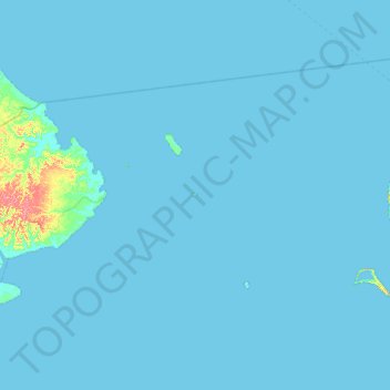
Name: Pulau Derawan topographic map, elevation, terrain.
Location: Pulau Derawan, East Kalimantan, Indonesia (1.96401 117.92396 2.60401 118.56396)
Average elevation: 2 m
Minimum elevation: -5 m
Maximum elevation: 85 m
Other topographic maps
Click on a map to view its topography, its elevation and its terrain.
Pulau Sodang-besar
Pulau Sodang-besar, East Kalimantan, Indonesia
Average elevation: 53 m