
Flint topographic map
Interactive map
Click on the map to display elevation.
About this map
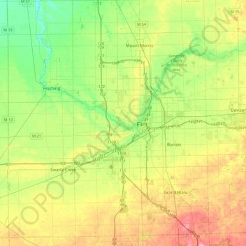
Name: Flint topographic map, elevation, terrain.
Location: Flint, Genesee County, Michigan, 48504, USA (42.85718 -83.88360 43.17718 -83.56360)
Average elevation: 239 m
Minimum elevation: 188 m
Maximum elevation: 320 m