Geolocate

Manicouagan topographic map

Interactive map

Click on the map to display elevation.

About this map

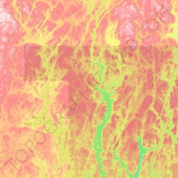
Name: Manicouagan topographic map, elevation, terrain.

Location: Manicouagan, Côte-Nord, Quebec, Canada (49.79567 -69.40767 51.07567 -68.12767)

Average elevation: 496 m

Minimum elevation: 112 m

Maximum elevation: 1,044 m

Other topographic maps

Click on a map to view its topography, its elevation and its terrain.

Daveluyville

Canada > Quebec > Arthabaska

Average elevation: 93 m

Saint-Pamphile

Canada > Quebec > L'Islet (MRC)

Average elevation: 336 m

Blainville

Canada > Quebec > Thérèse-De Blainville

Average elevation: 66 m

Amherst

Canada > Quebec > Les Laurentides

Average elevation: 286 m

Sainte-Barbe

Canada > Quebec > Sainte-Barbe

Average elevation: 47 m

Courcelles

Canada > Quebec > Courcelles

Average elevation: 385 m

Charlevoix

Canada > Quebec

Average elevation: 593 m

Sheenboro

Canada > Quebec > Sheenboro

Average elevation: 255 m

Mandeville

Canada > Quebec > Mandeville

Average elevation: 340 m