
Joseph Island topographic map
Interactive map
Click on the map to display elevation.
About this map
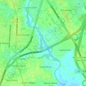
Name: Joseph Island topographic map, elevation, terrain.
Location: Joseph Island, Dover, Kent County, Delaware, USA (39.14270 -75.51240 39.14519 -75.51078)
Average elevation: 8 m
Minimum elevation: -2 m
Maximum elevation: 15 m