
Rockport topographic map
Interactive map
Click on the map to display elevation.
About this map
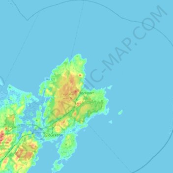
Name: Rockport topographic map, elevation, terrain.
Location: Rockport, Essex County, Massachusetts, 01966, United States (42.57989 -70.64403 42.74303 -70.49901)
Average elevation: 6 m
Minimum elevation: -4 m
Maximum elevation: 77 m