
Chilapa de Álvarez topographic map
Interactive map
Click on the map to display elevation.
About this map
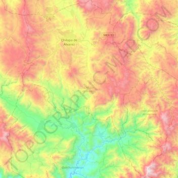
Name: Chilapa de Álvarez topographic map, elevation, terrain.
Location: Chilapa de Álvarez, Guerrero, 41100, Mexico (17.29608 -99.28623 17.68529 -98.88819)
Average elevation: 1,508 m
Minimum elevation: 524 m
Maximum elevation: 2,697 m
Other topographic maps
Click on a map to view its topography, its elevation and its terrain.