
Thank you for supporting this site ❤️
Make a donation
Make a donation
Lake Atitlán topographic map
Click on the map to display elevation.
Thank you for supporting this site ❤️
Make a donation
Make a donation
About this map
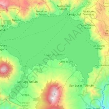
Name: Lake Atitlán topographic map, elevation, terrain.
Location: Lake Atitlán, San Pedro La Laguna, Sololá, 07013, Guatemala (14.61223 -91.28735 14.74814 -91.11540)
Average elevation: 1,782 m
Minimum elevation: 1,178 m
Maximum elevation: 3,138 m
Thank you for supporting this site ❤️
Make a donation
Make a donation
Other topographic maps
Click on a map to view its topography, its elevation and its terrain.