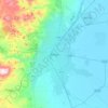
Bursa topographic map
Click on the map to display elevation.
Bursa
Bursa mostly experiences a Mediterranean climate (Csa and Csb). Inner parts of the province are higher in elevation and show continental characteristics (Dsb and Dsc). Uludağ is the highest mountain in the province with 2,543 meters of elevation.
About this map

Name: Bursa topographic map, elevation, terrain.
Location: Bursa, Marmara Region, Turkey (39.59351 28.08768 40.75773 29.91004)
Average elevation: 406 m
Minimum elevation: -1 m
Maximum elevation: 2,521 m
Other topographic maps
Click on a map to view its topography, its elevation and its terrain.