
Pavković Selo topographic map
Interactive map
Click on the map to display elevation.
About this map
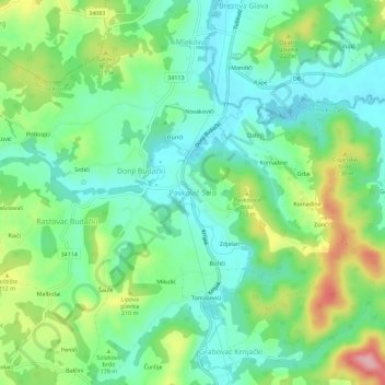
Name: Pavković Selo topographic map, elevation, terrain.
Location: Pavković Selo, Općina Krnjak, Karlovac County, 47242, Croatia (45.34470 15.58601 45.38470 15.62601)
Average elevation: 164 m
Minimum elevation: 112 m
Maximum elevation: 274 m