
Kgalagadi Transfrontier Park topographic map
Interactive map
Click on the map to display elevation.
About this map
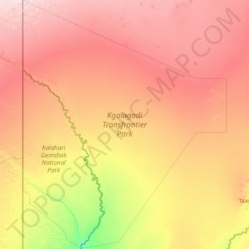
Name: Kgalagadi Transfrontier Park topographic map, elevation, terrain.
Location: Kgalagadi Transfrontier Park, Kgalagadi District, Botswana (-26.47676 19.99837 -24.09713 22.15744)
Average elevation: 1,021 m
Minimum elevation: 880 m
Maximum elevation: 1,209 m
Other topographic maps
Click on a map to view its topography, its elevation and its terrain.
Bokspits
Botswana > Kgalagadi District > Bokspits
Bokspits, Kgalagadi District, Botswana
Average elevation: 860 m