
Thank you for supporting this site ❤️
Make a donation
Make a donation
Mons topographic map
Click on the map to display elevation.
Thank you for supporting this site ❤️
Make a donation
Make a donation
About this map
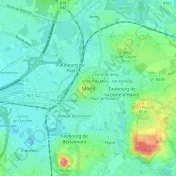
Name: Mons topographic map, elevation, terrain.
Location: Mons, Hainaut, Wallonia, 7000, Belgium (50.43185 3.92630 50.47821 4.00696)
Average elevation: 42 m
Minimum elevation: 21 m
Maximum elevation: 120 m
Thank you for supporting this site ❤️
Make a donation
Make a donation
Other topographic maps
Click on a map to view its topography, its elevation and its terrain.