
Thank you for supporting this site ❤️
Make a donation
Make a donation
São José do Rio Preto topographic map
Click on the map to display elevation.
Thank you for supporting this site ❤️
Make a donation
Make a donation
São José do Rio Preto
São José do Rio Preto is located in northwest of the state of São Paulo in a region between the rivers Grande, Paraná and Tietê. The ecosystem in the region lies between the Cerrado (Brazilian savanna) with traces of the Atlantic Forest. Topographycally, it is characterized by a slightly undulated relief, with a medium elevation of 489 m (1,604 ft).
Thank you for supporting this site ❤️
Make a donation
Make a donation
About this map
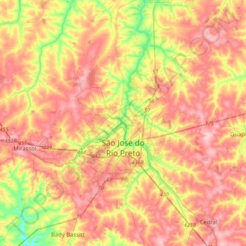
Name: São José do Rio Preto topographic map, elevation, terrain.
Average elevation: 527 m
Minimum elevation: 430 m
Maximum elevation: 602 m
Thank you for supporting this site ❤️
Make a donation
Make a donation