
Thank you for supporting this site ❤️
Make a donation
Make a donation
Brottö topographic map
Click on the map to display elevation.
Thank you for supporting this site ❤️
Make a donation
Make a donation
About this map
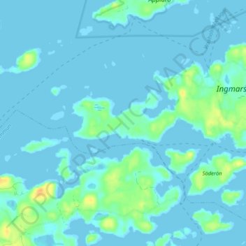
Name: Brottö topographic map, elevation, terrain.
Location: Brottö, Österåkers kommun, Stockholms län, Svezia (59.44840 18.70168 59.48840 18.74168)
Average elevation: 4 m
Minimum elevation: -3 m
Maximum elevation: 29 m
Thank you for supporting this site ❤️
Make a donation
Make a donation
Other topographic maps
Click on a map to view its topography, its elevation and its terrain.