
Make a donation
Matijevići topographic map
Click on the map to display elevation.
Make a donation
About this map
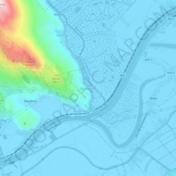
Name: Matijevići topographic map, elevation, terrain.
Average elevation: 49 m
Minimum elevation: -5 m
Maximum elevation: 558 m
Make a donation
Other topographic maps
Click on a map to view its topography, its elevation and its terrain.
Grad Ploče
Croatia > Dubrovnik-Neretva County
Ploče at an elevation of 2 metres (6.6 ft) is the location of Croatia's high temperature record, measured at 42.8 °C (109.0 °F) on 4 and 5 August 1981. Records for the Ploče weather station began in 1975. The coldest temperature was −8.9 °C (16.0 °F), on 13 January 1985.
Average elevation: 140 m
Lastovo
Croatia > Dubrovnik-Neretva County > Općina Lastovo
Since records began in 1949, the highest temperature recorded at the local weather station at an elevation of 186 metres (610 ft) was 38.3 °C (100.9 °F), on 3 August 1998. The coldest temperature was −6.8 °C (19.8 °F), on 23 January 1963.
Average elevation: 35 m
Make a donation
Make a donation
Make a donation
Make a donation
Make a donation
Make a donation
Make a donation
Make a donation
Make a donation