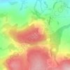
Latvia topographic map
Click on the map to display elevation.
Latvia
Coastal regions, especially the western coast of the Courland Peninsula, possess a more maritime climate with cooler summers and milder winters, while eastern parts exhibit a more continental climate with warmer summers and harsher winters. Nevertheless, the temperature variations are little as the territory of Latvia is relatively small. Moreover, Latvia's terrain is particularly flat (no more than 350 meters high), thus the Latvian climate is not differentiated by altitude.
About this map

Name: Latvia topographic map, elevation, terrain.
Location: Latvia (55.67465 20.60099 58.08557 28.24149)
Average elevation: 72 m
Minimum elevation: -3 m
Maximum elevation: 289 m
Other topographic maps
Click on a map to view its topography, its elevation and its terrain.



Maunatlala
As time passed by Kgosi Mapena’s eldest son who was named Maunatlala died, the village’ name was changed from Kopung to Maunatlala. Climatic Conditions The climate of Maunatlala area is semi-arid with dry winters and fairly wet summer months, with drought endemic. The average precipitation for the area is…
Average elevation: 878 m



Gaborone
Botswana > South-East District
Gaborone is situated at 24°39′29″S 25°54′44″E / 24.65806°S 25.91222°E / -24.65806; 25.91222 between Kgale and Oodi Hills, on the Notwane River in the south-eastern corner of Botswana, and 15 kilometres (9.3 mi) from the South African border The city lies at an elevation of 1,010 metres…
Average elevation: 1,032 m


Serule
Botswana > Central District > Serule
The population according to the 2001 census was 2,268 and it is estimated at more than 3000 in the latest 2011 census. The people of Serule Village comprises different ethnicities namely Bangwato, Bakwena, Batalaote, Bakalanga, Bahurutshe and its six wards are Mothoathubega, Borotsi, Mokwena, Botalaote,…
Average elevation: 935 m

Mahesana
India > Gujarat > Mahesana Taluka
Mehsana has an average elevation of 375 feet (114 m) above sea level. By Ahmedabad-Palanpur Railway line, the town is divided in two: the east and western parts are known as Mehsana-1 and Mehsana-2 respectively.
Average elevation: 92 m
Bhavani
India > Tamil Nadu > Mettupalayam
The Bhavani is a 234 km (145 mi) long perennial river fed by monsoons. The river originates at an altitude of 2,634 m (8,642 ft) in the Billimala range of the Nilgiris in the Western Ghats in Tamil Nadu. It flows westwards towards the Silent Valley National Park in Kerala, before later turning eastwards and…
Average elevation: 923 m


Beitbridge
Zimbabwe > Matabeleland South Province > Beitbridge > Municipality of Beitbridge
Average elevation: 479 m

Bcharreh Cedars of God Forest
Lebanon > North Governorate > El Arz
Time, along with the exploitation of the wood and the effects of climate change, has led to a decrease in the number of cedar trees in Lebanon. However, Lebanon is still widely known for its cedar tree history, as they are the emblem of the country and the symbol of the Lebanese flag. The remaining trees…
Average elevation: 1,959 m

Bredenfelde
Germany > Mecklenburg-Vorpommern > Mecklenburgische Seenplatte > Woldegk
Average elevation: 109 m




Antalya
While the city itself only has modest elevation changes, Antalya has high mountains in all directions to its interior. With moisture being trapped, the local climate thus has high winter rainfall, while the interior bay setting results in very hot summers for a coastal city.
Average elevation: 117 m






Mount Suswa
Kenya > Kajiado County > Kajiado West > Ewuaso Oonkidong'i ward
Average elevation: 2,044 m


Barasat
India > West Bengal > Barasat - I
Its average elevation is 11 metres (36 ft). The nearest river is the Ganges, about 15 kilometres (9.3 mi) to the west, and it is on the Gangetic plain.
Average elevation: 6 m

Jezzine
Jezzine (Arabic: جزين Jizzīn) is a municipality in Lebanon, located 22 km (14 mi) from Sidon and 40 km (25 mi) south of Beirut. It is the capital of Jezzine District. Surrounded by mountain peaks, pine forests (like the Bkassine Pine Forest), and at an average altitude of 950 m (3,117 ft), it is the main…
Average elevation: 1,072 m




Ballynahinch
United Kingdom > Northern Ireland
"Roads Service approved the stage 2 preferred options report for the scheme, including the recommendation for a preferred line for the A24 Ballynahinch bypass scheme around the eastern outskirts and adjacent to the development limit of the town. That line will run from the junction of the A24 Belfast Road and…
Average elevation: 100 m




Jebel Jais
Oman > Musandam Governorate > Bukha Province
Jebel Jais (Arabic: جبل جيس, romanized: Jabal Jays) is a mountain of the North-Western Hajar range in the Musandam Governorate of Oman and also in Ras Al Khaimah, United Arab Emirates. The summit has an elevation of 1,934 m (6,345 ft). The summit is located on the Omani side, but a high point west of…
Average elevation: 1,580 m