
Thank you for supporting this site ❤️
Make a donation
Make a donation
Bossière topographic map
Click on the map to display elevation.
Thank you for supporting this site ❤️
Make a donation
Make a donation
About this map
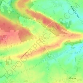
Name: Bossière topographic map, elevation, terrain.
Location: Bossière, Mettet, Namur, Wallonia, 5641, Belgium (50.32329 4.67669 50.36329 4.71669)
Average elevation: 248 m
Minimum elevation: 218 m
Maximum elevation: 280 m
Thank you for supporting this site ❤️
Make a donation
Make a donation