
Töre topographic map
Interactive map
Click on the map to display elevation.
About this map
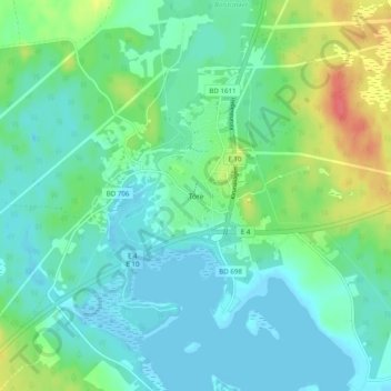
Name: Töre topographic map, elevation, terrain.
Location: Töre, Kalix kommun, Norrbotten County, 952 43, Sweden (65.89313 22.62783 65.93313 22.66783)
Average elevation: 14 m
Minimum elevation: -2 m
Maximum elevation: 53 m
Other topographic maps
Click on a map to view its topography, its elevation and its terrain.