
City of Saratoga Springs topographic map
Interactive map
Click on the map to display elevation.
About this map
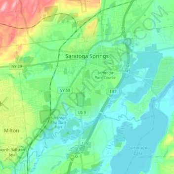
Name: City of Saratoga Springs topographic map, elevation, terrain.
Location: City of Saratoga Springs, Saratoga County, New York, USA (43.01542 -73.84978 43.10786 -73.69536)
Average elevation: 95 m
Minimum elevation: 57 m
Maximum elevation: 222 m