
Thank you for supporting this site ❤️
Make a donation
Make a donation
Hjelmeland topographic map
Click on the map to display elevation.
Thank you for supporting this site ❤️
Make a donation
Make a donation
About this map
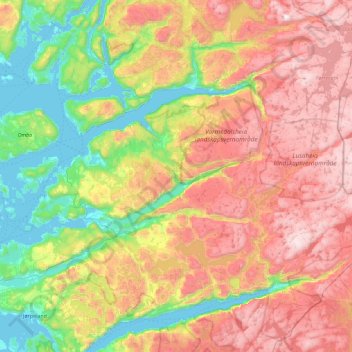
Name: Hjelmeland topographic map, elevation, terrain.
Location: Hjelmeland, Rogaland, Norway (59.03673 5.95215 59.37525 6.86514)
Average elevation: 569 m
Minimum elevation: -2 m
Maximum elevation: 1,341 m
Thank you for supporting this site ❤️
Make a donation
Make a donation
Other topographic maps
Click on a map to view its topography, its elevation and its terrain.
Thank you for supporting this site ❤️
Make a donation
Make a donation
Thank you for supporting this site ❤️
Make a donation
Make a donation