
Żabbar topographic map
Interactive map
Click on the map to display elevation.
About this map
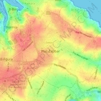
Name: Żabbar topographic map, elevation, terrain.
Location: Żabbar, South Eastern Region, Malta (35.86379 14.52651 35.88716 14.56464)
Average elevation: 38 m
Minimum elevation: 0 m
Maximum elevation: 62 m
Other topographic maps
Click on a map to view its topography, its elevation and its terrain.