
Thank you for supporting this site ❤️
Make a donation
Make a donation
Mirandela topographic map
Click on the map to display elevation.
Thank you for supporting this site ❤️
Make a donation
Make a donation
About this map
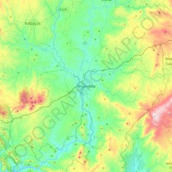
Name: Mirandela topographic map, elevation, terrain.
Location: Mirandela, Bragança District, 5370-460, Portugal (41.32962 -7.33748 41.64962 -7.01748)
Average elevation: 450 m
Minimum elevation: 162 m
Maximum elevation: 1,193 m
Thank you for supporting this site ❤️
Make a donation
Make a donation