
Thank you for supporting this site ❤️
Make a donation
Make a donation
Jocotepec topographic map
Click on the map to display elevation.
Thank you for supporting this site ❤️
Make a donation
Make a donation
About this map
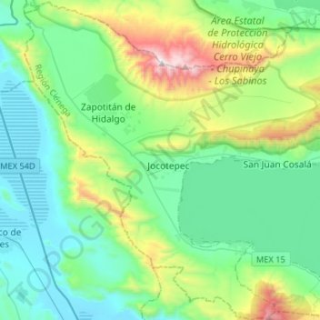
Name: Jocotepec topographic map, elevation, terrain.
Location: Jocotepec, Jalisco, Mexico (20.16736 -103.54831 20.41134 -103.28632)
Average elevation: 1,710 m
Minimum elevation: 1,345 m
Maximum elevation: 2,949 m
Thank you for supporting this site ❤️
Make a donation
Make a donation