
Postojna topographic map
Interactive map
Click on the map to display elevation.
About this map
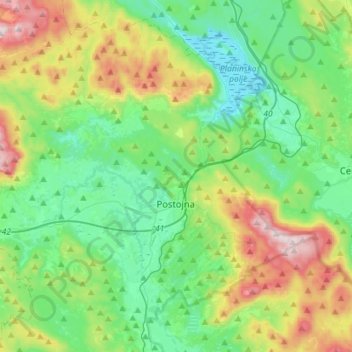
Name: Postojna topographic map, elevation, terrain.
Location: Postojna, Littoral–Inner Carniola Region, Slovenia (45.70144 14.04237 45.87910 14.32601)
Average elevation: 675 m
Minimum elevation: 439 m
Maximum elevation: 1,256 m