
Włocławek topographic map
Interactive map
Click on the map to display elevation.
About this map
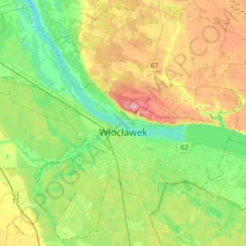
Name: Włocławek topographic map, elevation, terrain.
Location: Włocławek, Kuyavian-Pomeranian Voivodeship, Poland (52.59479 18.93905 52.73597 19.18261)
Average elevation: 71 m
Minimum elevation: 32 m
Maximum elevation: 134 m