
Thank you for supporting this site ❤️
Make a donation
Make a donation
Lodève topographic map
Click on the map to display elevation.
Thank you for supporting this site ❤️
Make a donation
Make a donation
About this map
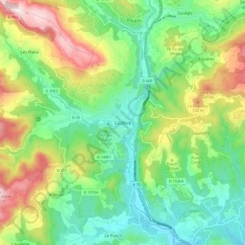
Name: Lodève topographic map, elevation, terrain.
Location: Lodève, Hérault, Occitanie, France métropolitaine, 34700, France (43.69106 3.27892 43.77106 3.35892)
Average elevation: 318 m
Minimum elevation: 116 m
Maximum elevation: 696 m
Thank you for supporting this site ❤️
Make a donation
Make a donation